


Voting District 0600016, Suffolk County, New York
About
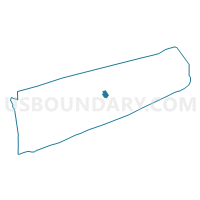
Outline

Summary
| Unique Area Identifier | 637471 |
| Name | Voting District 0600016 |
| County | Suffolk County |
| State | New York |
| Area (square miles) | 6.20 |
| Land Area (square miles) | 6.18 |
| Water Area (square miles) | 0.02 |
| % of Land Area | 99.67 |
| % of Water Area | 0.33 |
| Latitude of the Internal Point | 40.97454790 |
| Longtitude of the Internal Point | -72.59459470 |
Maps


Graphs
Select a template below for downloading or customizing gragh for Voting District 0600016, Suffolk County, New York


Neighbors
Neighoring Voting District (by Name) Neighboring Voting District on the Map
- Voting District 0600000, Suffolk County, NY
- Voting District 0600007, Suffolk County, NY
- Voting District 0600008, Suffolk County, NY
- Voting District 0600021, Suffolk County, NY
- Voting District 1000000, Suffolk County, NY
- Voting District 1000012, Suffolk County, NY
- Voting District 1000013, Suffolk County, NY
Top 10 Neighboring County Subdivision (by Population) Neighboring County Subdivision on the Map
Top 10 Neighboring Place (by Population) Neighboring Place on the Map
- Mattituck CDP, NY (4,219)
- Aquebogue CDP, NY (2,438)
- Jamesport CDP, NY (1,710)
- Laurel CDP, NY (1,394)
- Northville CDP, NY (1,340)
Top 10 Neighboring Unified School District (by Population) Neighboring Unified School District on the Map
- Riverhead Central School District, NY (38,457)
- Mattituck-Cutchogue Union Free School District, NY (9,193)